A couple of years ago my eldest son, Merle, bought a GPS receiver. GPS, the Global Positioning System, uses signals from atomic clocks on satellites to compute locations. It's a matter of geometry plus clever math, including Kalman Filtering. (More on that another time; meanwhile, see SubbookKeeping, 21 June 2000.)
I have something of an attachment to GPS, intellectually, since when I was finishing up graduate school (ca. 1979) among the places that I interviewed for possible jobs was a smallish high-tech company (whose name now escapes me, alas) involved in setting up and running the system. (There are several bits of tricky physics in GPS including some relativity, my field. Nerdy pun intended!)
But coming down to Earth and back to the present: Merle sold me his GPS receiver and I've been carrying it along when I go jogging around the neighborhood, mostly with my younger son, Robin. It's a pleasant distraction. I take data points every minute or so, and when I get home I enter them into a simple spreadsheet. Then I can plot them on a little chart. Goofy, I know, and a waste of time ... but it's the kind of thing that certain analytical personalities (like mine) groove on.
The fun really began when I used Mapquest (http://www.mapquest.com with thanks to Globexplorer and Airphoto USA) to grab some aerial photos of the route. I put the pictures together and superposed my GPS measurements. Yes, it's crude — I merely scaled the raw data graph by eye to match a few major landmarks. But it's amusing to look at a bird's eye view of where I've been puffing and sweating so hard. Here's the image (all processing done in Apple Works):
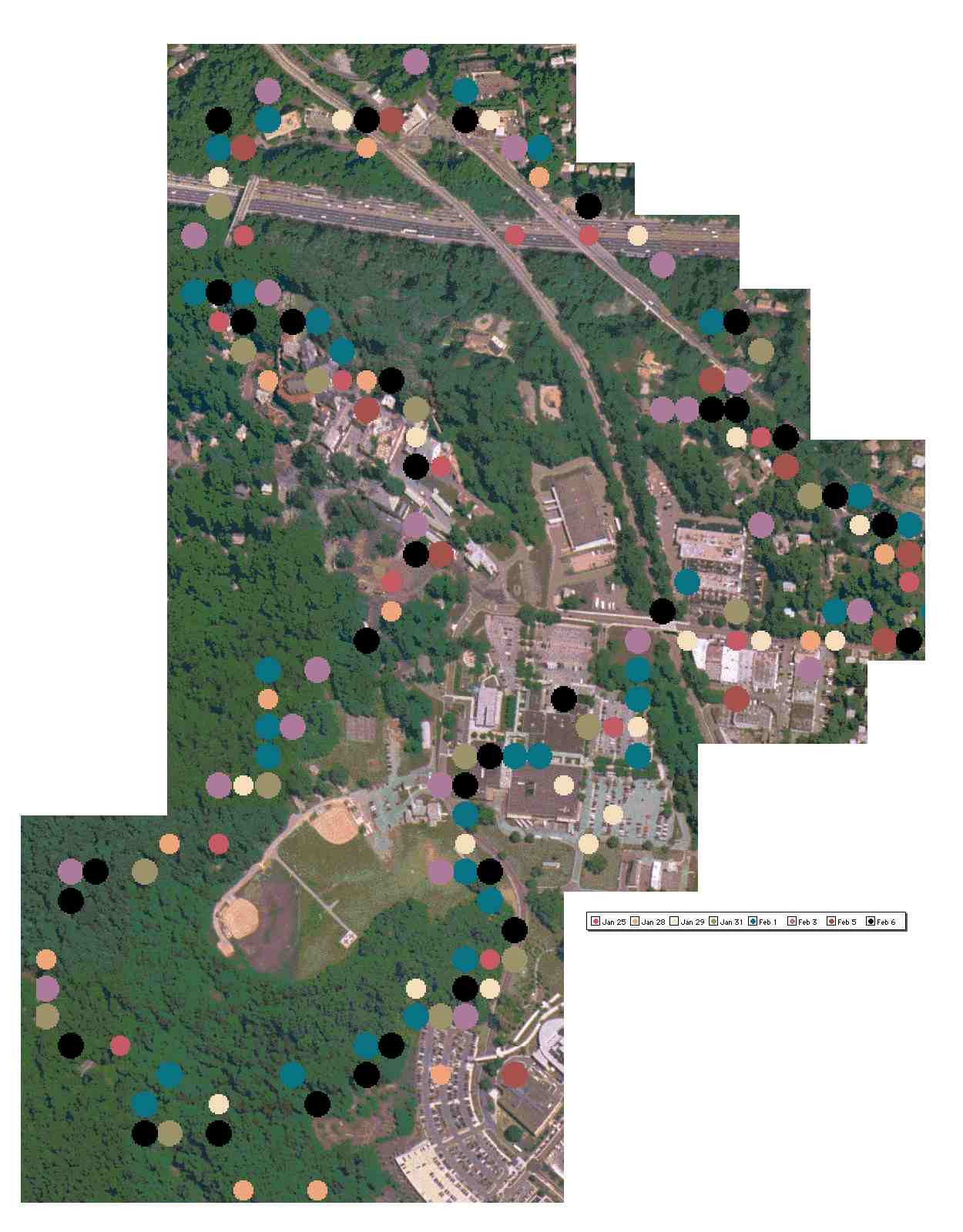
My customary path is a couple of miles long. It leads me northwest from home, across a bridge above a major highway (Interstate 495, aka the Capital Beltway, a ring road that circles Washington DC). Then I go over a railroad grade crossing, south via another freeway bridge, and enter the US Army's Walter Reed Annex, an area that was a resort and a girls' finishing school a century ago. From there it's down a pleasant forest trail and back up a (steep!) hill, to the buildings that comprise the Post Exchange. Then east across the train tracks, down a few residential streets, and back to my house from the other side.
As you can see, I didn't get the locations quite aligned, on top of which there are random GPS errors of plus or minus a second or so of arc in latitude and longitude. But overall, it's a kinda cute result for a first hike into satellite-based mapping and precision navigation on shoestrings and shoe leather ...
TopicRunning - TopicPersonalHistory - TopicScience - 2002-02-16
(correlates: CoarseCorrection, UpsideDownShadows, SonnetForMyDaughterInLaw, ...)